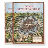
Braun/Hogenberg, Cities of the World
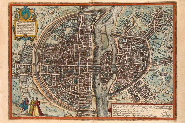
View of Paris.
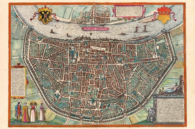
View of Cologne.
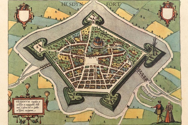
View of Hesdin.
Ralph Johns reviews a massive offering from Taschen:'Cities of the World', the complete edition of colour plates from 1572-1617.
Four hundred years ago, New Zealand lay undiscovered by Europeans in Terra Australis. At the same time, a German theologian was editing the sixth and final volume of the monumental project civitates orbis terrarum, Cities of the World. Georg Braun’s richly illustrated books, generally available and affordable thanks to the revolutionary printing press, were highly sought after in Renaissance Europe by a middle class eager to learn more about the expanding world. The volumes, published between 1572 and 1617, contained plans, bird’s-eye drawings and descriptions of every major European city as well as significant settlements from Africa, Asia and Central America.
Facsimiles from a set of six well preserved books in Frankfurt have been brought together and edited by scholar Stephan Füssel in a massive 500 page hardback (with slipcase) from Taschen. In addition to the colour plates, Füssel has written in great detail on the history of how the volumes were produced as well as providing translations of the map text and insights into the political and cultural context of the cities depicted.
Numerous mainland cities from northern Europe are illustrated, their clustered cell-like forms contained within defensive walls, moats and fortifications. Where routes meet they merge to form public spaces that relate to markets, governance and religion. Coastal cites, increasingly strategic because of trade with the New World, extend their defenses around harbours, wharves, canals, basins and breakwaters, the city walls rising directly out of the sea to offer safe haven.
Many European cities are instantly recognisable by their context and urban form; their arrangement of streets, open spaces and fortifications has endured and is embedded in the layout of the modern city. On the other hand, the New World cities have changed beyond recognition. Four centuries ago Mexico City stood on a series of islets in the middle of a lake – the Spanish church and square at its centre is all that remains in today’s megacity.
This book presents a view of cities shaped by trade, religion, conquest and war. After four decades of massively destructive conflicts, the expansion and contraction of global empires and rampant industrialisation, it is remarkable how resilient the urban form of Old World cities has been. From a New Zealand perspective, the maps and plans offer a glimpse of the forces of colonialism that would lead to a new network of cities around the globe.