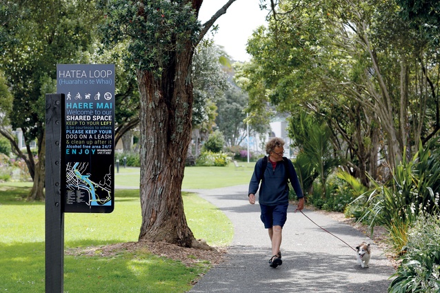
Huarahi o te Whai
The 4.2km walk winds around the Whangarei’s inner harbour.
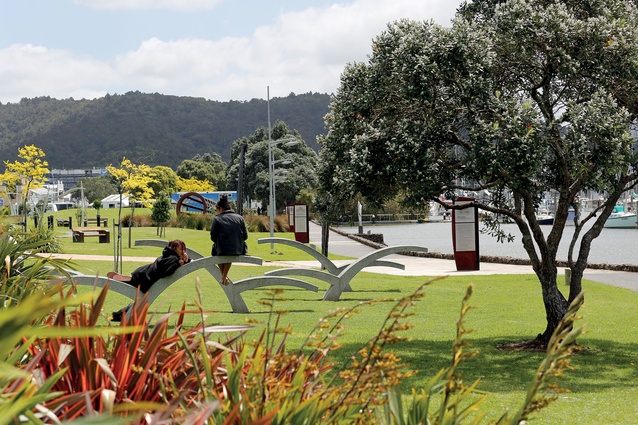
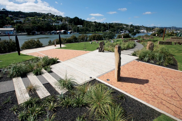
Art and sculpture is part of the landscape’s dialogue.
The walk reduces the perceived distance between different landscapes.
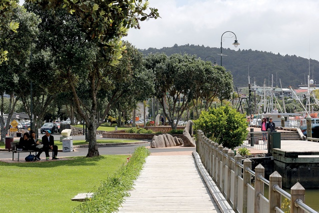
A 2.5-meter-wide, 2.6km multi-use trail establishes a framework from which to add to in future.
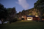
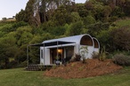
A marine aesthetic was retained.
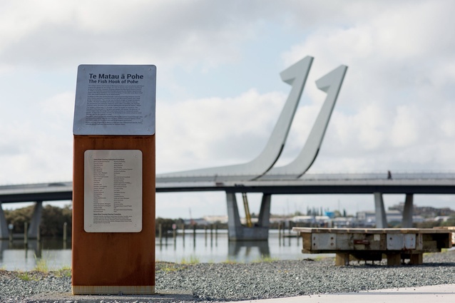
The bascule bridge provides a backdrop to parts of the loop walk.
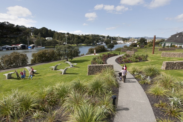
The path reclaims large areas of what was under-utilised land.
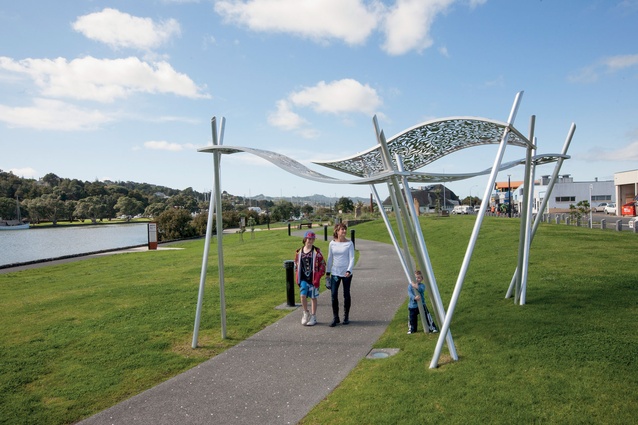
Sculpture adorns the path at various points.
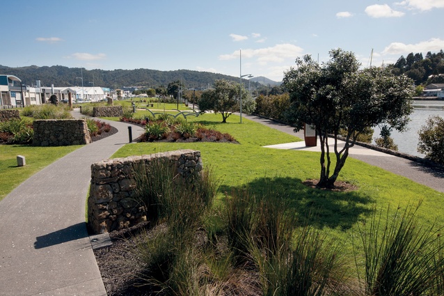
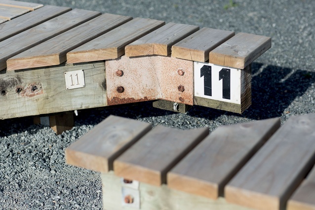
The path is designed as a shared space.
The new bridges and a loop walkway bring back into community stewardship some once neglected landscapes of Whangarei’s inner harbour. The bridges – a cycle/pedestrian footbridge, Kotuitui Whiti, crosses Waiarohia Stream, and the award-winning fishhook bascule bridge, Te Matau a Pohe, takes the Hatea Loop across the Hatea River. The walkway will also be referred to as “Huarahi o te Whai” - pathway of opportunity.
The 4.2km loop walkway, which includes a new, 2.5-metre wide, 2.6km long concrete multi-use trail, establishes a framework to which features will be added over time, thereby expanding the range of experiences along its route, says Bruno Gilmour, senior landscape architect at Whangarei District Council (WDC).
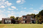
The Hatea Loop takes in the Town Basin where boats are moored and unites it with a capped landfill and an esplanade reserve that had been lost to public use. The landfill area on Pohe Island is now a grassed, park-like space, used increasingly by the public since the walkway opened on 13 September 2014. The Okara Esplanade Reserve was utilised for decades by small boat building industries and has been reclaimed.
“The project brings back the collective conversation areas that have been physically neglected and out of public mind. We called it “The Loop” for a long time and that has become part of its formal name,” Gilmour says.
The loop weaves together conversations from the area including collective stories and memories. The fishhook-shaped bascule of Te Matau a Pohe that lifts for boats to pass is named after the fishhook of Pohe, a fisherman who once lived on the island. Kotuitui Whiti, meaning ‘to interweave and connect with the land,’ is a swivel bridge that opens like a gate and has a distinctively different design. The piles symbolise the ko, a Maori digging stick, the stainless steel woven-mesh sides (a net), and the weaving patterns of the kete (food bag) are reflected in the deck. A conscious decision was made not to reference the large bridge and avoid it becoming its “little brother,” Gilmour says.
“Part of the walkway’s appeal is that it crosses the Hatea River twice and the Waiarohia Stream once. Both bridges opening in sequence adds another dynamic experience. Seeing the traffic bridge is utterly surreal – a huge piece of road lifting up in front of you is sci-fi stuff.”
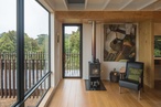
The landscaping also avoids picking up the architecture of Te Matau a Pohe, although materials left from its construction were bought and used to create spaces on the Hatea Loop. For example, large universal beams were stood on end near the bridge and concrete blocks were used like bollards to segregate traffic from pedestrian movement. Resurfaced segments of pontoon from a marina were turned into seating and the fixings retained.
“They have a marine-industrial aesthetic but with a surface suitable for seating,” Gilmour says.
Different activities will be added to the loop over time such as high adrenalin-type sports and multi-generational play equipment. Already there is a skate park and BMX track, and a parkour/running site is planned.
To increase people’s connection with the water, mangrove trees were selectively removed where growth was thin and they were obstructing the view across the river. Where there was some ecological integrity, the stands of mangroves were retained.
“The walkway diminishes the perceived distances between the different landscapes. Being able to see better across the river improves the dialogue between spaces.”
Many art works, such as Chris Booth’s Waka and Wave sculptures at the eastern entrance to the Whangarei Town Basin, or the smaller Landfall by Justen Murfitt that depicts Seabirds Landing in a rest area on Riverside Road are also part of the dialogue, and the city’s relationship with manmade and natural environments.
“You can see the artworks at different points along the walkway and river. They provide connectivity and draw you on around the loop.”
The walkway follows the water on both sides of the river and there is parking and access at different points. Water access by kayak is another layer of experience, and Gilmour says many people attended the opening by means of kayak and paddleboard. More jetties and viewing platforms will be built to allow people greater access from the water.
Gilmour says some of the landscapes had been neglected in a cultural sense and their stories are conveyed through bi-lingual interpretation panels.
“In the 19th and 20th centuries, landforms were levelled and dumped into other areas to create fill so there were issues for local Maori in taking what is potentially tapu land and burying it in the river to create flat areas. We have been working with local iwi through the iwi liaison team at council to at least represent some of the local stories about those landscapes. It is thought that the way people came up with stories and narratives was by walking through landscapes. The experience of walking around these landscapes ties in the past, the present and looks towards the future.”
“Huarahi o te Whai” - pathway of opportunity.