River Lane, Waiuku
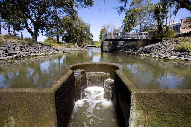
Keyhole shaped weir in Waiuku River.
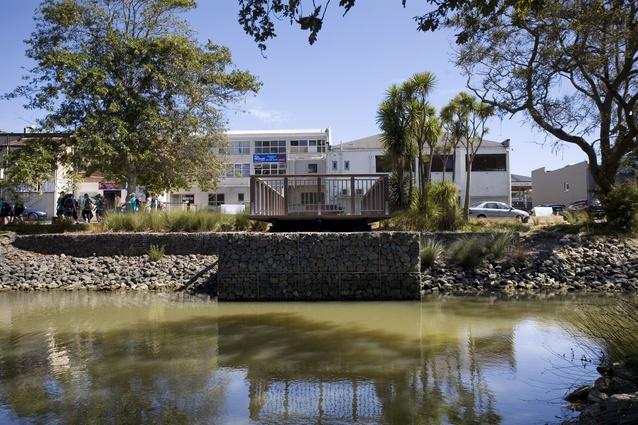
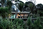
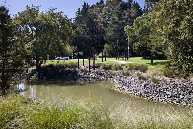
View across Waiuku River to new River Lane works by Reset Urban Design.
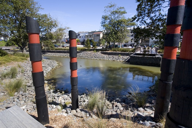
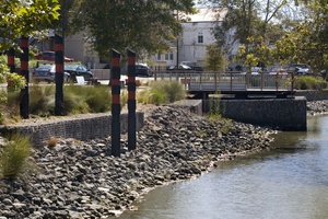
Wharf-pile-referencing artworks.
Opposite view.
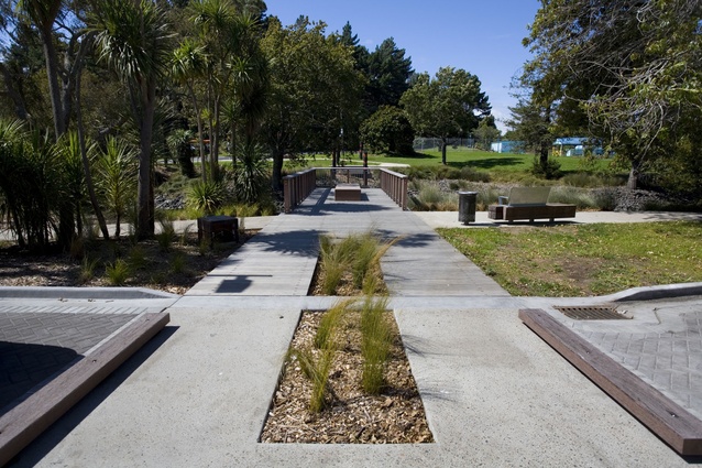
River Lane walkway and seating.
View from pier, with public seating and new planting.
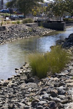
Rip rap edging to the river.
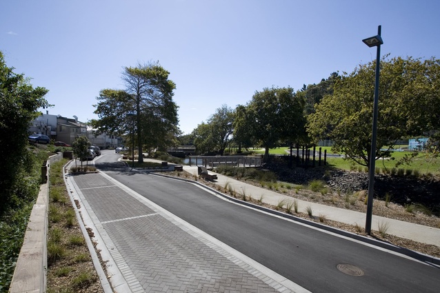
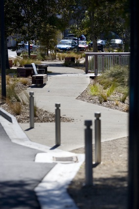
River Lane paving and lighting.
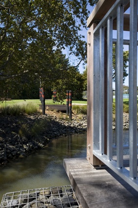
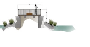
Detail of pier.
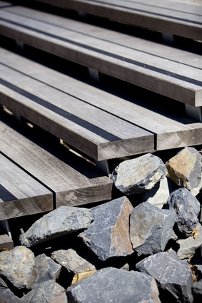
Stair detail.
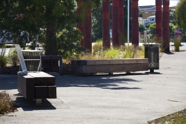
Public seating.
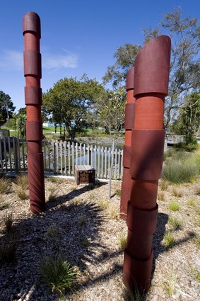
Sculptural detail.
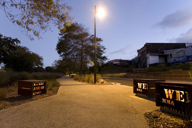
River Lane at night.
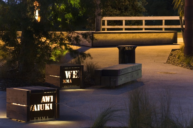
River Lane at night.
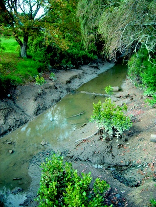
Before shot of Waiuku River.
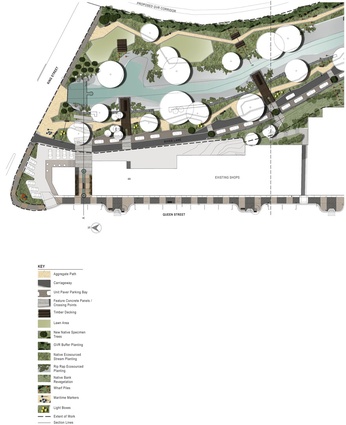
Plan of site.
Before it turned away from the water, Waiuku’s river was an active port and part of its proud face. This century, Reset Urban Design has put in place a number of intiatives to turn the town back to the river.
Waiuku. Small town, big history. Despite being just 40 kms from Auckland, and meaning no disrespect to its 6,000-odd inhabitants, it’s an outpost. More rural than urban, it was pre-supercity, part of the Franklin District Council and, at one stage, with a roughly proposed boundary between Waikato and Auckland heading down the middle of Colombo Road, potentially a part of both provinces. Before a few lifestylers saw the benefits of a town so close to two main centres, the town was for the most part a support act for the local farming community that surrounds it and a dormitory for workers at the Glenbrook Steel Mill just four kilometres away. But don’t be deceived into thinking its a roughneck steel town. It is, with its mix of small-scale heritage buildings, very charming.
The Waiuku Town Centre Legacy Report 2005-2011 indicates the colonial significance of this town; it was one of New Zealand’s first towns, with a port established in 1843 on a historical Maori portage route – a connection point between the Manukau Harbour and the Waikato River. The town was mapped out in 1851, the same year that the town’s Kentish Hotel, which is still pouring pints today, came into existence. Geographically, Waiuku is located among a wide variety of ecological areas, estuary system, rural land, west coast beaches and river systems. More than a century ago, as historical photography attests, the Waiuku River was an important part of the town’s infrastructure. Over time, the importance of the river began to diminish until mid-way through the first decade of this century it was a choked, estuarine mess. The kind of place where you’re more likely to come across an abandoned shopping trolley than an aquatic lifeform.
Since 2005, however, the town has undergone a number of upgrades planned and designed by Reset Urban. Problems that Reset identified back in ’05 were “poor natural and cultural links, poor water quality in streams, underutilised spaces and reserves, underdeveloped areas, a town turned away from river and harbour edge and key buildings unconnected to street.”
Stages 1–2 of this ongoing project involved street enhancements, with visible elements including a paving palette for the town centre that employs bluestone and light-coloured concrete pavers and exposed aggregate concrete. The designers also devised a suite of street furniture that links to the past by employing traditional fretwork patterns and, to explain the town’s past, and possibly in anticpation of a rise in tourist numbers post-design, there’s a series of information panels dotting the town. The town square also had an upgrade, with a timber stage installed for events, and a central clock tower cleverly reclad in a kind of filigreed steel that ties in with the afoermentioned street furniture. There are also wonderfully slanted street lighting elements, vaguely reminiscent of listing yacht masts.
River Lane is the third stage of this project. Garth Falconer, Reset’s director, says this stage of the development was part of a “strategy to better connect this former maritime settlement with its harbour and estuarine edges, providing new recreational, social and economic opportunities.”
Waiuku is a good example of a town that turned its back on the river before coming back to the well. The urban designers stemmed the flow, literally, with a weir, and metaphorically, by providing the kind of amenity that makes the river edge a good place to walk, or sit and eat lunch. By redirecting attention towards this space, the designers have also highlighted the potential benefits of further development across the road at the rivermouth and across the river, where an underused reserve sits patiently waiting for attention.
River Lane is a neat piece of work; a long-time in the making, as you might expect in a small town with limited resources. Back in 2009, the first phase of the riverside work included armouring the banks of the river with riverstones, upgrading the stormwater system, building “gabion and riprap edges to the inlet”, and installing the weir which, at 300mm below mean tide level, provides “a larger, more-permanent water body”. This rise in water level, on the right tide, does wonders for this setting and wooden piers, or lookouts, which are firmly planted on the large rectangular gabion plinths, allow you to get right out over the water. Tying both sides of the river together are a series of artfully placed poles – wharf-like piles that hark back to the days of the port. Similarly, custom-made lightbox seats recall this historical aspect. Each is detailed with the name of a ship that once frequented the town’s wharf.
One of Reset’s key moves, I think, to encourage people into this area was to strengthen the corners at each end of the new boulevard. It’s obvious that there is something interesting happening down here. Landscape architecture, it is said, is a slow art, and while there are still further stages of work planned for Waiuku it is, to an extent, up to the people to embrace change. The buildings that line River Lane still have that lean-to-look familiar to anyone who has taken a walk along an alleyway behind a main street in a New Zealand town – but there are encouraging signs here that some businesses are taking the cue and turning back to face the river.